Comune di Nardò
Ing. Nicola D'Alessandro - Geom. Luigi De Benedittis
pianificazione
-
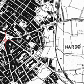
prg+vincoli base
Abstract :
Keyword list :
Projection : EPSG:32633
Bounding Box : 715000, 4438000, 770000, 4477000
prg+vincoli base
Load the map
View metadata
- Illustration
- Title
- prg+vincoli base
- Abstract
-
- Projection
- EPSG:32633
- Bounding Box
- 715000, 4438000, 770000, 4477000
- Web Map Service
- WMS Url
- WMTS Url
-
PRG
Abstract :
Keyword list :
Projection : EPSG:32633
Bounding Box : 731087, 4442882, 776090, 4473695
PRG
Load the map
View metadata
- Illustration
- Title
- PRG
- Abstract
-
- Projection
- EPSG:32633
- Bounding Box
- 731087, 4442882, 776090, 4473695
- Web Map Service
- WMS Url
- WMTS Url
-

02v3_pptr
Abstract :
Keyword list :
Projection : EPSG:32633
Bounding Box : 715000, 4438000, 770000, 4477000
02v3_pptr
Load the map
View metadata
- Illustration
- Title
- 02v3_pptr
- Abstract
-
- Projection
- EPSG:32633
- Bounding Box
- 715000, 4438000, 770000, 4477000
- Web Map Service
- WMS Url
- WMTS Url
-

PAI
Abstract : Piano Assetto Idrogeologico
Keyword list :
Projection : EPSG:32633
Bounding Box : 731087, 4442882, 776090, 4473695
PAI
Load the map
View metadata
- Illustration
- Title
- PAI
- Abstract
- Piano Assetto Idrogeologico
- Projection
- EPSG:32633
- Bounding Box
- 731087, 4442882, 776090, 4473695
- Web Map Service
- WMS Url
- WMTS Url
-

Catasto Incendi
Abstract :
Keyword list :
Projection : EPSG:32633
Bounding Box : 719889.1841788562014699, 4438154.54707129206508398, 806442.12239903095178306, 4479439.21216376032680273
Catasto Incendi
Load the map
View metadata
- Illustration
- Title
- Catasto Incendi
- Abstract
-
- Projection
- EPSG:32633
- Bounding Box
- 719889.1841788562014699, 4438154.54707129206508398, 806442.12239903095178306, 4479439.21216376032680273
- Web Map Service
- WMS Url
- WMTS Url
-

Piano di zonizzazione acustica
Abstract :
Keyword list :
Projection : EPSG:32633
Bounding Box : 715000, 4438000, 770000, 4477000
Piano di zonizzazione acustica
Load the map
View metadata
- Illustration
- Title
- Piano di zonizzazione acustica
- Abstract
-
- Projection
- EPSG:32633
- Bounding Box
- 715000, 4438000, 770000, 4477000
- Web Map Service
- WMS Url
- WMTS Url
-

webgis_nardo_aree_escluse_142c2_
Abstract :
Keyword list :
Projection : EPSG:32633
Bounding Box : 715894.42850000003818423, 4436625.85500000044703484, 786275.22510000003967434, 4487979.97860000003129244
webgis_nardo_aree_escluse_142c2_
Load the map
View metadata
- Illustration
- Title
- webgis_nardo_aree_escluse_142c2_
- Abstract
-
- Projection
- EPSG:32633
- Bounding Box
- 715894.42850000003818423, 4436625.85500000044703484, 786275.22510000003967434, 4487979.97860000003129244
- Web Map Service
- WMS Url
- WMTS Url
-

08_piano_coste_comunale
Abstract :
Keyword list :
Projection : EPSG:32633
Bounding Box : 738261.69420000002719462, 4441401.46870000008493662, 770785.48600000003352761, 4464526.43589999992400408
08_piano_coste_comunale
Load the map
View metadata
- Illustration
- Title
- 08_piano_coste_comunale
- Abstract
-
- Projection
- EPSG:32633
- Bounding Box
- 738261.69420000002719462, 4441401.46870000008493662, 770785.48600000003352761, 4464526.43589999992400408
- Web Map Service
- WMS Url
- WMTS Url
cartografia
-
Carta tecnica regionale
Abstract :
Keyword list :
Projection : EPSG:32633
Bounding Box : 731087, 4442882, 776090, 4473695
Carta tecnica regionale
Load the map
View metadata
- Illustration
- Title
- Carta tecnica regionale
- Abstract
-
- Projection
- EPSG:32633
- Bounding Box
- 731087, 4442882, 776090, 4473695
- Web Map Service
- WMS Url
- WMTS Url
-
catasto_wms
Abstract :
Keyword list :
Projection : EPSG:3045
Bounding Box : 731087, 4442882, 776090, 4473695
catasto_wms
Load the map
View metadata
- Illustration
- Title
- catasto_wms
- Abstract
-
- Projection
- EPSG:3045
- Bounding Box
- 731087, 4442882, 776090, 4473695
- Web Map Service
- WMS Url
- WMTS Url
-
aerofotogrammetrie storiche
Abstract :
Keyword list :
Projection : ESRI:102092
Bounding Box : 2750445, 4443890, 2788346, 4472138
aerofotogrammetrie storiche
Load the map
View metadata
- Illustration
- Title
- aerofotogrammetrie storiche
- Abstract
-
- Projection
- ESRI:102092
- Bounding Box
- 2750445, 4443890, 2788346, 4472138
- Web Map Service
- WMS Url
- WMTS Url
-

IGM
Abstract :
Keyword list :
Projection : EPSG:32633
Bounding Box : 731087, 4442882, 776090, 4473695
IGM
Load the map
View metadata
- Illustration
- Title
- IGM
- Abstract
-
- Projection
- EPSG:32633
- Bounding Box
- 731087, 4442882, 776090, 4473695
- Web Map Service
- WMS Url
- WMTS Url